SSZTBQ9 january 2016 CC2640
Guest blog by Matt Johnson, CTO, Bluvision
The expectations of Real-Time Locating Systems (RTLS) have been on the rise in recent years. The driving factor for growth has been the promise of precise asset tracking. However, most RTLS solutions aren’t equipped to scale, at least not without significant investment and cost of ownership. Bluvision, a complete Internet of Things (IoT) ecosystem provider, has managed to solve the challenge of scalability without compromising on accuracy, revolutionizing RTLS.
A RTLS Solution That Scales
Bluvision’s RTLS solution uses Bluetooth® low energy and Wi-Fi® technology along with sophisticated algorithms in the cloud to enable tracking and monitoring of assets. The combination of Bluzone – our cloud solution – and our Bluetooth-to-Wi-Fi gateway called “BluFi,” gives our customers the ability to track and monitor assets (equipment or people) without the need for a smartphone applications or expensive hardware. In minutes, you can quickly install and connect our BluFi gateways to our IoT Cloud and start your RTLS project. Our “install and go” solution gives enterprises the ability to quickly manage thousands of devices/assets and gain visibility into their precise location, at scale. Capabilities like REST APIs, cutting-edge sensors and hardware, cloud-based location policies, drawing small to complex geofences, and handling big data, gives Bluvision the ability to handle complex and fluid RTLS environments like airports, manufacturing facilities, and so forth.
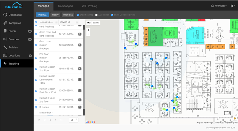
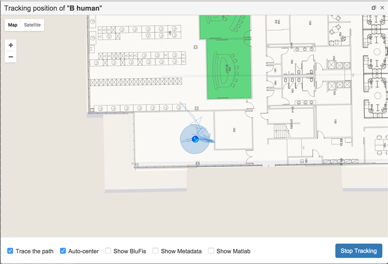
Example of the Bluvision RTLS demo
Accuracy under Three Feet
The fact that Bluvision is using Bluetooth low energy sensors, Bluetooth to Wi-Fi gateways and the cloud means that we are able to provide high accuracy – down to under three feet with minimal footprint, even in harsh RF conditions. Using TI’s leading SimpleLink™ Bluetooth low energy CC2640 wireless microcontroller (MCU), enables us to provide superior accuracy at a fraction of the cost compared to competing technologies like RFID and GPS. This apart, RFID and GPS also come with a high cost of ownership and serious infrastructure costs. Our solution uses minimum hardware that is fast and easy to implement.
Making Sense of Complex Data
The advanced algorithms that we use are capable of converting complicated configurations into human readable format. Bluzone has various RTLS components built into it that promises unprecedented accuracy and range. One of the key features of the solution is the ability to create unique geofences with ease. Enterprises can not just monitor when an asset enters the geofences, but are also capable of recording history of movement of these assets that enable predictive analysis.
With new wireless technologies, the scope and reach of RTLS promises to grow. We aim to continue to redefine how technology can be used for indoor location. To see a live demo of our RTLS solution, stop by the TI Village (#N115-N118) at CES 2016. Can't make it to CES? Check out the video below to see the demo from the show floor.
For more information about TI at CES 2016 visit www.ti.com/ces2016