SPRACX2 April 2021 TDA4VM , TDA4VM-Q1
- Trademarks
- 1Introduction
- 2What is Structure From Motion?
- 3Introduction to Occupancy Grid Mapping
- 4From Point-Cloud to OG Map
- 5Algorithm Flow: SFM-Based OG Mapping
- 6Algorithm Flow: SFM-Based OG Mapping on TDA4VM
- 7First Example Implementation on TDA4VM
- 8Second Example implementation on TDA4VM
- 9References
3 Introduction to Occupancy Grid Mapping
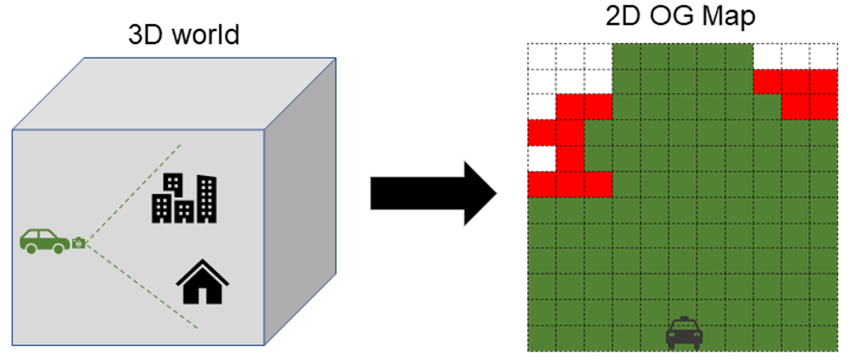
Occupancy Grid Maps are a widely used method to represent the environment surrounding a vehicle or robot, because they can be consumed by a variety of ADAS applications ranging from parking, to obstacle identification, to curb detection, and be stored efficiently. An OG map is a representation of a vehicle’s surroundings in the form of a 2-Dimensional (2D) or 3-Dimensional (3D) grid. Each grid cell in the map has a corresponding state, for example occupied, free or unknown, computed from information received from sensors such as RADARs, Cameras, or LiDARs. A simple illustrative example of an OG map is shown in Figure 3-1.
OG maps can either be centered on the vehicle or robot, or centered on an arbitrary frame of reference. The former is known as an ego-centric OG map and the latter as a world-centric OG map. OG maps are further categorized as accumulated or instantaneous, based on whether or not information from previous frames is used.
 Figure 3-1 Left: Illustration of World;
Right: Illustration of an OG Map
Figure 3-1 Left: Illustration of World;
Right: Illustration of an OG Map(Green cells empty, Red cells occupied, and white unknown)
This application report describes a world-centric 2D OG map constructed using a point-cloud generated from measurements acquired by a monocular camera. This OG map has three states – occupied, free or unknown. The primary focus of this application report will be on an instantaneous OG mapping algorithm. Then, towards the latter part of the article, an accumulated OG mapping application that is also included with the Software Development Kit (SDK) that accompanies the TDA4VM device is briefly described. The next section describes how to take a point-cloud as input and generate an OG map based on the point-cloud and the location of the vehicle/robot.